



3D LiDAR Scanning in Mine Collapse Emergency Response: Lessons from a Real Case in the US
When a mine suddenly collapses, the first and hardest task isn’t repair — it’s assessing the site without putting anyone else at risk. This was exactly the situation a mining operator in Iowa, USA, recently faced. The story below, adapted from a real case study by Artec 3D, shows how 3D LiDAR scanning technology is transforming how the mining industry responds to hazardous incidents.
The Situation: A Site No Human Could Safely Access
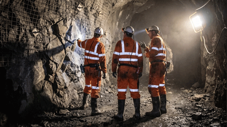
A mining area of roughly 9 hectares in Iowa suddenly experienced ground collapse. The mine was highly unstable, with ongoing rockfalls, tight access points, flooding, and — since it was located deep underground — no GPS signal for navigation. Sending personnel in to inspect directly wasn’t an option. But without assessing the extent of the damage, the operator couldn’t plan a response either.
The Solution: A Drone-Mounted LiDAR Scanner, Fully Autonomous
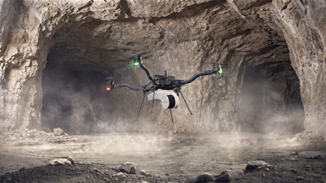
The mine operator deployed the Artec Jet — a LiDAR scanner built on SLAM (Simultaneous Localization and Mapping) technology, mounted on a drone to autonomously fly into the hazardous zone without a human pilot.
What makes this remarkable is that the device operates entirely without GPS — which simply doesn’t exist underground. Thanks to SLAM technology, it navigates and positions itself in real time using the very data it’s collecting, squeezing through gaps as narrow as 15-20 cm, avoiding obstacles, and maintaining stable operation even after losing signal for over 20 minutes.
The Result: The Entire Area Mapped in 48 Hours
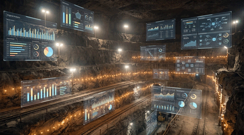
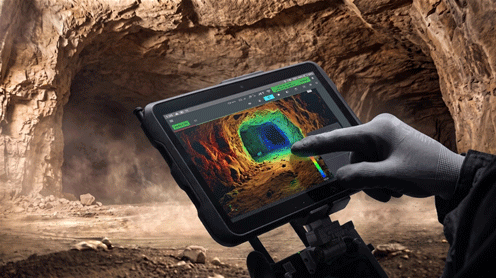
Within 48 hours of the emergency call, the drone-mounted scanner had completely mapped the collapse zone, capturing data at a rate of nearly two million points per second. The resulting point cloud revealed the condition of the surrounding support pillars, signs of water pooling contributing to instability, and safe access routes for future recovery work.
Combined with 360-degree camera footage, the engineering team gained full visual context without anyone having to step into a hazardous area — one with over 12 meters of standing water and rocks still actively collapsing.
An Unexpected Payoff: Uncovering the Root Cause
Interestingly, the team also had LiDAR data from the same mine captured a year earlier. By overlaying the new scan onto that baseline, they discovered the support pillars had been gradually weakening over time, and water from a nearby farmer’s field had been quietly seeping into the area for an extended period, slowly weakening the limestone foundation.
As a result, the 3D scan didn’t just document the damage — it became a forensic engineering tool, helping the operator understand the root cause and make informed decisions about safely reopening the site.
The Takeaway: From Emergency Response to Proactive Monitoring
Following the incident, the mine operator decided to invest in its own LiDAR scanning system, establishing a regular scanning schedule — weekly at first, then monthly — to continuously monitor ground conditions, rather than relying on the technology only when disaster strikes.
This is the biggest lesson here: 3D scanning technology isn’t just valuable for responding to incidents — its greatest value lies in prevention, catching early signs of instability before they become a disaster.
The Iowa case is clear proof that 3D LiDAR scanning is no longer a “nice to have” — it’s becoming an essential part of the safety infrastructure in mining, construction, and other hazardous work environments. If your business needs a solution for monitoring or assessing sites that are hard to access or unsafe for personnel, Scantech is ready to advise on the right 3D scanning solution.
👉 Contact Scantech for a 3D scanning solutions consultation:
📞 Hotline: 0904 985 139 / 0862 170 366
📧 Email: ktscantech@gmail.com
🌐 Website: https://scantechvn.com
📘 Fanpage: facebook.com/scantechvn
🏢 Address: Xóm 2 Phúc Đức, Quốc Oai, Hanoi
Content adapted from a real case study by Artec 3D.
.svg)
.svg)
.svg)
OTHER NEWS